Visita la galleria
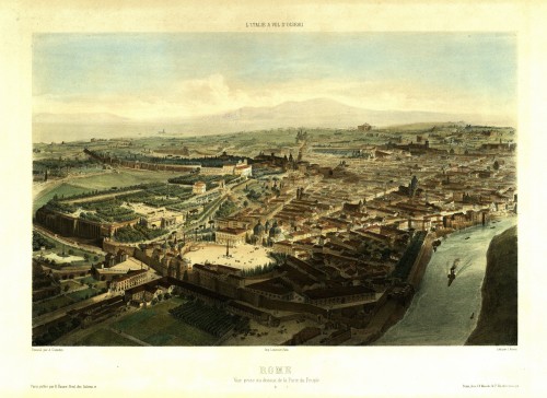
Between the 1400s and the 1600s, Rome’s layout changed drastically as a result of work on the City walls, the road network, bridges and aqueducts. The first overarching project, conceived by Nicolas V for the Jubilee of 1450, addressed a need to reorganize the Vatican area, which remained the focus in Sixtus’ IV renewal plan for 1475. As well as restoring churches and palazzos and undertaking major architectural intervention, Sixtus IV attended to the city’s road network and the routes followed by pilgrims. His flagship project was Ponte Sisto, which he built to reduce traffic over Ponte Sant’Angelo – at that time the only bridge over the Tiber in the vicinity of the Vatican. He created the Borgo Sant’Angelo area to facilitate access between Castel Sant’Angelo and San Pietro. For the 1500 Jubilee, Alexander VI built Via Alessandrina, a road that was later swallowed up by Via della Conciliazione. During the mid-1500s, it became vital to build links between places of worship in a city characterized by the Counterreformation, confraternities and huge processions. For the 1575 Jubilee, Gregory XIII built what today is known as Via Merulana, between St Mary Major and St John Lateran in a part of town that had fallen into neglect after the papal seat had quit it for the Vatican. Sixtus V (1585-1590) went on to remodel the area as part of his far-reaching urban redevelopment plan. The long straight roads between Rome’s most important churches and basilicas that Sixtus brought in were the hallmark feature of the city until a new wave of redevelopment plans arrived in the late 1800s and early 1900s.